Anexo:Registro Nacional de Lugares Históricos en Queens
Esta lista incluye 93 propiedades y distritos listados en el Registro Nacional de Lugares Históricos en el borough de Queens, Nueva York.[1]
Esta lista proveída por el Servicio de Parques Nacionales está completa según el listado reciente del Registro Nacional de Lugares Históricos entregados el 7 de septiembre de 2012.
Lista de propiedades
| [2] | Nombre | imagen | Fecha listada | Dirección | Localidad | Resumen |
|---|---|---|---|---|---|---|
| 1 | 1964-1965 New York World's Fair New York State Pavilion | 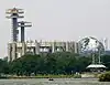 1964-1965 New York World's Fair New York State Pavilion |
20 de noviembre de 2009 | Flushing Meadows – Corona Park 40°44′39″N 73°50′40″O |
Flushing | |
| 2 | Estación 45th Road – Court House Square (Dual System IRT) | 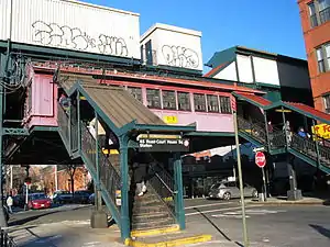 Estación 45th Road – Court House Square (Dual System IRT) |
30 de marzo de 2005 | Arriba de 23rd St. entre 44th Dr. y 45ht Rd. 40°44′47″N 73°56′45″O |
Long Island City | |
| 3 | Distrito histórico de la Avenida 68-64th Place | 30 de septiembre de 1983 | Cerca de 64th Pl. desde Catalpa Ave. a 68th Ave. desde 64th St. a 65th St. 40°42′20″N 73°53′40″O |
Ridgewood | ||
| 4 | Distrito histórico de la Avenida 75-Calle 61 | 30 de septiembre de 1983 | Bordeada por St. Felix Ave., 60th Lane, 60th and 62nd Sts. 40°41′55″N 73°53′41″O |
Ridgewood | ||
| 5 | Casa Allen-Beville | 22 de septiembre de 1983 | 29 Center Dr. 40°46′22″N 73°45′03″O |
Douglaston | ||
| 6 | Casa Louis Armstrong | 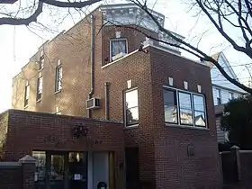 Casa Louis Armstrong |
11 de mayo de 1976 | 3456 107th St. 40°45′20″N 73°51′43″O |
Corona | |
| 7 | Astoria Center of Israel | 16 de octubre de 2009 | 27-35 Crescent St. 40°46′13″N 73°55′26″O |
Astoria | ||
| 8 | Bohemian Hall and Park | 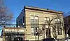 Bohemian Hall and Park |
23 de marzo de 2001 | 29-19 24th Ave. 40°46′22″N 73°54′59″O |
Astoria | |
| 9 | Casa John Bowne | .jpg.webp) Casa John Bowne |
13 de septiembre de 1977 | 37-01 Bowne St. 40°45′46″N 73°49′32″O |
Flushing | |
| 10 | Distrito histórico de Broadway-Flushing | 12 de mayo de 2006 | Bordeada por 29th Ave., 163rd St., 32nd Ave., 192nd St., 154th and 153rd Sts. 40°46′00″N 73°48′05″O |
Flushing | ||
| 11 | Casa Ralph Bunche | 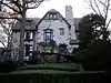 Casa Ralph Bunche |
11 de mayo de 1976 | 115-125 Grosvenor Rd. 40°42′25″N 73°50′16″O |
Kew Gardens | |
| 12 | Distrito histórico de la Avenida Central | 30 de septiembre de 1983 | Bordeada por Myrtle and 70th Ave., and 65th and 66th Sts. 40°42′10″N 73°53′25″O |
Ridgewood | ||
| 13 | Distrito histórico de Central Ridgewood | 30 de septiembre de 1983 | Bordeada por Fresh Pond Rd., Putnam, 68th, Forest, Catalpa, Onderdonk, and 71st Aves. 40°42′10″N 73°53′57″O |
Ridgewood | ||
| 14 | The Church-in-the-Gardens | 11 de diciembre de 2009 | 50 Ascan Ave. 40°42′55″N 73°50′33″O |
Forest Hills | ||
| 15 | Iglesia de la Resurrección | 7 de marzo de 2003 | 85-09 118th St. 40°42′08″N 73°49′57″O |
Kew Gardens/Richmond Hill)|Kew Gardens | ||
| 16 | Congregation Tifereth Israel | 21 de noviembre de 2002 | 109-18 and 109-20 54th Ave. 40°44′32″N 73°51′12″O |
Corona | ||
| 17 | Distrito histórico de la Avenida Cooper | 30 de septiembre de 1983 | 6434-6446 Cooper Ave. 40°41′53″N 73°53′27″O |
Ridgewood | ||
| 18 | Distrito histórico de Cornelia-Putnam | 30 de septiembre de 1983 | Bordeada por Jefferson St., Putnam, Wyckoff, and Myrtle Aves. 40°41′56″N 73°54′27″O |
Ridgewood | ||
| 19 | Cornell Farmhouse | 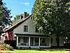 Cornell Farmhouse |
24 de julio de 1979 | 73-50 Little Neck Pkwy 40°44′54″N 73°43′14″O |
Floral Park | |
| 20 | Distrito histórico de la Avenida Cypress Este | 30 de septiembre de 1983 | Bordeada por Linden and Cornelia Sts., Seneca and St. Nicholas Aves. 40°42′06″N 73°54′31″O |
Ridgewood | ||
| 21 | Distrito histórico de la Avenida Cypress Oeste | 30 de septiembre de 1983 | Bordeada por St. Nicholas and Seneca Aves., Linden and Stockholm Sts. 40°42′06″N 73°54′15″O |
Ridgewood | ||
| 22 | Distrito histórico de Douglaston Hill | 31 de agosto de 2000 | Bordeada por Douglaston Pkwy., Northern Blvd., 244th St., 243rd St., and Long Island RR 40°46′03″N 73°44′43″O |
Douglaston | ||
| 23 | Distrito histórico de Douglaston | 1 de septiembre de 2005 | Bordeada por Shore Rd., Marinette St., Douglas Rd. and Cherry St. 40°46′33″N 73°45′02″O |
Douglaston | ||
| 24 | Elmhurst Avenue Subway Station (IND) | 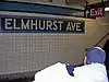 Elmhurst Avenue Subway Station (IND) |
6 de julio de 2005 | Beneath Broadway at 82nd St. and 45th Ave. and Elmhurst Ave. 40°44′33″N 73°52′56″O |
Elmhurst | |
| 25 | Evergreens Cemetery | 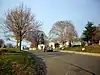 Evergreens Cemetery |
15 de noviembre de 2007 | 1629 Bushwick Ave. 40°41′02″N 73°54′04″O |
Ridgewood | |
| 26 | Firemen's Hall | 31 de agosto de 2000 | 13-28 123rd St. 40°47′09″N 73°50′44″O |
College Point | ||
| 27 | First Reformed Church | 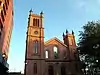 First Reformed Church |
16 de abril de 1980 | 153-10 Jamaica Ave. 40°42′09″N 73°48′08″O |
Jamaica | |
| 28 | Flushing Armory | 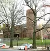 Flushing Armory |
23 de marzo de 1995 | 137-58 Northern Boulevard 40°45′47″N 73°49′46″O |
Flushing | |
| 29 | Flushing High School | .jpg.webp) Flushing High School |
10 de febrero de 1992 | 35-01 Union St. 40°45′54″N 73°49′39″O |
Flushing | |
| 30 | Flushing Town Hall | 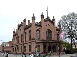 Flushing Town Hall |
16 de marzo de 1972 | 137-35 Northern Blvd. 40°45′50″N 73°49′49″O |
Flushing | |
| 31 | Forest Park Carousel | 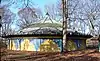 Forest Park Carousel |
16 de julio de 2004 | Woodhaven Blvd. and Myrtle Ave. 40°42′03″N 73°51′31″O |
Woodhaven | |
| 32 | Distrito histórico de Forest-Norman | 30 de septiembre de 1983 | Forest Ave. from Summerfield to Stephen St. and Norman St. to Myrtle Ave. 40°41′59″N 73°53′58″O |
Middle Village | ||
| 33 | Distrito histórico de Fort Tilden | 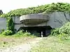 Distrito histórico de Fort Tilden |
20 de abril de 1984 | Rockaway Beach Boulevard 40°33′50″N 73°53′28″O |
Rockaway | |
| 34 | Fort Totten Officers' Club | 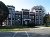 Fort Totten Officers' Club |
17 de marzo de 1986 | Totten and Murray Aves. 40°47′32″N 73°46′41″O |
Bayside | |
| 35 | Free Synagogue of Flushing | 16 de octubre de 2009 | 41-60 Kissena Blvd. 40°45′27″N 73°49′40″O |
Flushing | ||
| 36 | Distrito histórico de Fresh Pond-Traffic | 30 de septiembre de 1983 | Bordeada por Fresh Pond Rd., Traffic Ave., Woodbine and Linden Sts. 40°42′34″N 73°53′49″O |
Ridgewood | ||
| 37 | Grace Episcopal Church Complex | 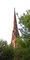 Grace Episcopal Church Complex |
8 de septiembre de 1983 | 15515 Jamaica Avenue 40°42′14″N 73°48′07″O |
Jamaica | |
| 38 | Distrito histórico de Grove-Linden-Calle St. John | 30 de septiembre de 1983 | Fairview Ave., St. John's Rd., Linden and Grove Sts. 40°42′23″N 73°54′26″O |
Middle Village | ||
| 39 | Distrito histórico de Hunters Point | 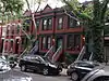 Distrito histórico de Hunters Point |
19 de septiembre de 1973 | Along 45th Ave., between 21st and 23rd Sts. 40°44′49″N 73°56′48″O |
Long Island City | |
| 40 | Distrito histórico de Jackson Heights | 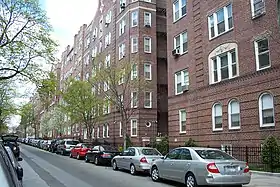 Distrito histórico de Jackson Heights |
27 de enero de 1999 | Bounded by Roosevelt Ave., Broadway, Leverich St., Northern Blvd., and 90th St. 40°45′05″N 73°53′13″O |
Jackson Heights | |
| 41 | Distrito histórico de Jacob Riis Park | 17 de junio de 1981 | Rockaway Beach Blvd. 40°34′03″N 73°52′24″O |
Rockaway | ||
| 42 | Edificio de la Cámara de Comercio de Jamaica | 8 de septiembre de 1983 | 8931 161st St. 40°42′19″N 73°48′00″O |
Jamaica | ||
| 43 | Jamaica Savings Bank | 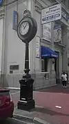 Jamaica Savings Bank |
19 de mayo de 1983 | 161-02 Jamaica Ave. 40°42′14″N 73°47′57″O |
Jamaica | |
| 44 | King Manor | 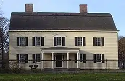 King Manor |
2 de diciembre de 1974 | 150th St. and Jamaica Ave. 40°42′11″N 73°51′43″O |
Jamaica | |
| 45 | Kingsland Homestead | 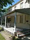 Kingsland Homestead |
31 de mayo de 1972 | 37th St. and Parsons Blvd. 40°45′49″N 73°49′27″O |
Flushing | |
| 46 | Edificio J. Kurtz and Sons Store | 8 de septiembre de 1983 | 162-24 Jamaica Ave. 40°42′15″N 73°47′50″O |
Jamaica | ||
| 47 | La Casina | 1 de marzo de 1990 | 90-33 160th St. 40°42′16″N 73°48′00″O |
Jamaica | ||
| 48 | Lent Homestead and Cemetery | 2 de febrero de 1984 | 78-03 19th Rd. 40°46′23″N 73°53′31″O |
Jackson Heights | ||
| 49 | Long Island City Courthouse Complex | 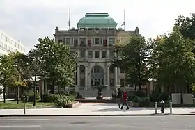 Long Island City Courthouse Complex |
26 de septiembre de 1983 | 25-10 Court Sq. 40°44′45″N 73°56′36″O |
Long Island City | |
| 50 | Long Island Motor Parkway |  Long Island Motor Parkway |
1 de abril de 2002 | Cerca de Alley Pond and Cunningham Parks, bet. Winchester Blvd. and Clearview Expressway, bet. 73rd Ave. and Peck Ave. 40°44′13″N 73°45′35″O |
Queens | |
| 51 | Distrito histórico de Madison-Putnam-60th Place | 30 de septiembre de 1983 | Bordeada por Woodbine St., 60th Pl., 67th and Forest Aves. 40°42′21″N 73°54′06″O |
Ridgewood | ||
| 52 | Main Street Subway Station (Dual System IRT) | 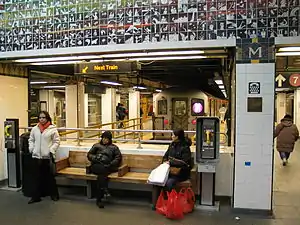 Main Street Subway Station (Dual System IRT) |
14 de octubre de 2004 | Near jct. of Roosevelt Ave. and Main St. 40°45′34″N 73°49′51″O |
Flushing | |
| 53 | Maple Grove Cemetery | 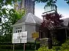 Maple Grove Cemetery |
20 de agosto de 2004 | 83-15 Kew Gardens Rd. 40°42′31″N 73°49′27″O |
Kew Gardens | |
| 54 | Marine Air Terminal | 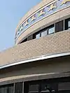 Marine Air Terminal |
9 de julio de 1982 | Aeropuerto La Guardia 40°46′25″N 73°53′10″O |
Aeropuerto La Guardia | |
| 55 | Office of the Register | 3 de enero de 1980 | 161-04 Jamaica Ave. 40°42′13″N 73°47′57″O |
Jamaica | ||
| 56 | Old Quaker Meetinghouse | 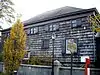 Old Quaker Meetinghouse |
24 de diciembre de 1967 | S side of Northern Blvd. 40°45′47″N 73°49′51″O |
Flushing | |
| 57 | Paramount Studios Complex | 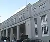 Paramount Studios Complex |
14 de noviembre de 1978 | 35th Ave., 35th, 36th, and 37th Sts. 40°45′24″N 73°55′30″O |
Astoria | |
| 58 | Parkway Village (Queens, New York) | 28 de febrero de 2012 | Bounded by Union Tpk., 150th St., Goethals Ave., Parsons Blvd., Grand Central Pkwy., & Main St. 40°43′02″N 73°48′46″O |
Kew Gardens Hills | ||
| 59 | Poppenhusen Institute | 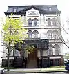 Poppenhusen Institute |
18 de agosto de 1977 | 114-04 14th Rd. 40°47′04″N 73°51′13″O |
College Point | |
| 60 | Prospect Cemetery | 11 de enero de 2002 | 159th St. and Beaver Rd. 40°42′04″N 73°48′01″O |
Jamaica | ||
| 61 | Public School 66 | 28 de agosto de 2003 | 85-11 102nd St. 40°41′52″N 73°50′47″O |
Richmond Hill | ||
| 62 | Queens County Savings Bank | 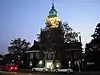 Queens County Savings Bank |
16 de junio de 2005 | 75-44 Main St. 40°43′21″N 73°49′14″O |
Kew Gardens Hills | |
| 63 | Puente de Queensboro | 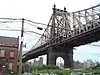 Puente de Queensboro |
20 de diciembre de 1978 | 59th St. 40°45′26″N 73°57′22″O |
Long Island City | |
| 64 | Reformed Church of Newtown Complex | 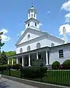 Reformed Church of Newtown Complex |
23 de abril de 1980 | 85-15 Broadway 40°44′23″N 73°52′42″O |
Elmhurst | |
| 65 | Rego Park Jewish Center | 28 de octubre de 2009 | 97-30 Queens Blvd. 40°43′41″N 73°51′34″O |
Rego Park | ||
| 66 | RKO Keith's Theater (Flushing, New York) | 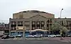 RKO Keith's Theater (Flushing, New York) |
29 de octubre de 1982 | 129-143 Northern Blvd. 40°45′48″N 73°49′57″O |
Flushing | |
| 67 | Russell Sage Memorial Church | 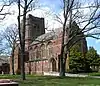 Russell Sage Memorial Church |
22 de septiembre de 1986 | 1324 Beach 12 St. 40°36′34″N 73°44′51″O |
Far Rockaway | |
| 68 | Saint Benedict Joseph Labre Parish | 25 de enero de 2007 | 94-40 118th St. 40°41′33″N 73°49′47″O |
Richmond Hill | ||
| 69 | St. George's Church | 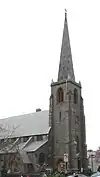 St. George's Church |
7 de marzo de 2008 | 135-32 38th Ave. 40°45′37″N 73°49′55″O |
Flushing | |
| 70 | St. James Church, Elmhurst | 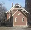 St. James Church, Elmhurst |
12 de noviembre de 1999 | 86-02 Broadway 40°44′18″N 73°52′41″O |
Elmhurst | |
| 71 | St. Luke's Episcopal Church | 10 de noviembre de 2010 | 85 Greenway South 40°42′50″N 73°50′41″O |
Forest Hills | ||
| 72 | St. Matthew's Episcopal Church | _Episcopal_Church%252C_Woodhaven_jeh.jpg.webp) St. Matthew's Episcopal Church |
25 de mayo de 2001 | 85-45 96th St. 40°41′46″N 73°50′58″O |
Woodhaven | |
| 73 | St. Monica's Church | 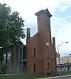 St. Monica's Church |
9 de abril de 1980 | 94-20 160th St. 40°42′07″N 73°47′53″O |
Jamaica | |
| 74 | Distrito histórico de la Avenida Seneca Este | 30 de septiembre de 1983 | Cerca de Seneca Ave. E. between Hancock and Summerfield Sts. 40°41′59″N 73°54′07″O |
Ridgewood | ||
| 75 | Distrito histórico de Seneca-Onderdonk-Woodward | 30 de septiembre de 1983 | Bordeada por Woodward, Seneca, Catalpa Aves., and Woodbine St. 40°42′09″N 73°54′17″O |
Middle Village | ||
| 76 | Sidewalk Clock at 161-11 Jamaica Avenue, New York, NY | _Street_Clock.JPG.webp) Sidewalk Clock at 161-11 Jamaica Avenue, New York, NY |
18 de abril de 1985 | 161-11 Jamaica Ave. 40°42′15″N 73°47′56″O |
Jamaica | |
| 77 | Steinway Mansion | 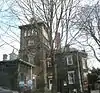 Steinway Mansion |
8 de septiembre de 1983 | 18-22 41st St. 40°46′42″N 73°53′52″O |
Astoria | |
| 78 | Distrito histórico de Stockholm-DeKalb-Hart | 30 de septiembre de 1983 | Cerca de DeKalb and Woodward Aves., Stockholm and Hart Sts. 40°42′32″N 73°54′52″O |
Ridgewood | ||
| 79 | Distrito histórico de la Calle Summerfield | 30 de septiembre de 1983 | 5912-5948 Summerfield St. 40°42′01″N 73°53′48″O |
Ridgewood | ||
| 80 | Distrito histórico de Sunnyside Gardens | 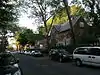 Distrito histórico de Sunnyside Gardens |
7 de septiembre de 1984 | Bordeada por Queens Blvd., 43rd and 52nd Sts. Barnett and Skillman Aves. 40°44′49″N 73°55′03″O |
Sunnyside Gardens | |
| 81 | Trans World Airlines Flight Center | 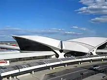 Trans World Airlines Flight Center |
7 de septiembre de 2005 | John F. Kennedy International Airport 40°38′45″N 73°46′39″O |
Jamaica | |
| 82 | Trinity Chapel | 11 de enero de 2002 | 1874 Mott Avenue 40°36′13″N 73°45′05″O |
Far Rockaway | ||
| 83 | Trinity Lutheran Church | 29 de mayo de 2008 | 31-18 37th St. 40°45′42″N 73°55′09″O |
Astoria | ||
| 84 | US Post Office-Far Rockaway | 17 de noviembre de 1988 | 18-36 Mott Avenue 40°36′12″N 73°45′03″O |
Far Rockaway | ||
| 85 | US Post Office-Flushing Main | 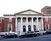 US Post Office-Flushing Main |
17 de noviembre de 1988 | 41-65 Main St. 40°45′33″N 73°49′43″O |
Flushing | |
| 86 | US Post Office-Forest Hills Station | 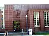 US Post Office-Forest Hills Station |
17 de noviembre de 1988 | 106-28 Queens Blvd. 40°43′18″N 73°50′50″O |
Forest Hills | |
| 87 | US Post Office-Jackson Heights Station | 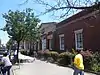 US Post Office-Jackson Heights Station |
17 de noviembre de 1988 | 78-02 37th Ave. 40°44′57″N 73°53′16″O |
Jackson Heights | |
| 88 | US Post Office-Jamaica Main | 17 de noviembre de 1988 | 88-40 164th St. 40°42′N 73°48′O |
Jamaica | ||
| 89 | US Post Office-Long Island City | 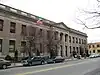 US Post Office-Long Island City |
11 de mayo de 1989 | 46-02 21st St. 40°44′44″N 73°56′57″O |
Long Island City | |
| 90 | Casa Cornelius Van Wyck | 6 de octubre de 1983 | 37-04 Douglaston Parkway 40°46′23″N 73°45′12″O |
Douglaston | ||
| 91 | Sitio de la Casa Vander Ende-Onderdonk | 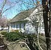 Sitio de la Casa Vander Ende-Onderdonk |
31 de enero de 1977 | 1820 Flushing Ave. 40°42′40″N 73°55′12″O |
Ridgewood | |
| 92 | Distrito histórico de Woodbine-Palmetto-Gates | 30 de septiembre de 1983 | Bordeada por Forest and Fairview Aves., Woodbine and Linden Sts. 40°42′25″N 73°54′15″O |
Middle Village | ||
| 93 | Wyckoff-Snediker Family Cemetery | 25 de mayo de 2001 | 85-45 96th St. 40°41′46″N 73°50′57″O |
Woodhaven |
Véase también
Referencias
- La información de la latitud y longitud proveída en esta tabla fue obtenida originalmente por el Sistema de Información del Registro Nacional de Lugares Históricos, que ha sido verás el 99% de las veces. El 1% de las coordenadas de la NRIS, podrían tener pequeños errores, pero no lejos de su localidad; algunas correcciones se han hecho. Un problema más sutil causa que muchos lugares estén a un máximo de 150 yardas, de su ubicación original, dependiendo de la ubicación en el país: la mayoría de las coordenadas de la NRIS fueron obtenidas de mapas de cuadrantes topográficos de la USGS creados bajo Fecha de utilidad de conversión de América del Norte de 1927, en la cual difiere, de los sistemas actuales GPS usados por Google mapas.
- Numbers represent an ordering by significant words. Various colorings, defined here, differentiate National Historic Landmarks and historic districts from other NRHP buildings, structures, sites or objects.
Enlaces externos
 Wikimedia Commons alberga una categoría multimedia sobre Registro Nacional de Lugares Históricos en Queens.
Este artículo ha sido escrito por Wikipedia. El texto está disponible bajo la licencia Creative Commons - Atribución - CompartirIgual. Pueden aplicarse cláusulas adicionales a los archivos multimedia.