Anexo:Registro Nacional de Lugares Históricos en Brooklyn
Esta lista incluye 157 propiedades y distritos listados en el Registro Nacional de Lugares Históricos en el borough de Brooklyn, Nueva York.[1]
Esta lista proveída por el Servicio de Parques Nacionales está completa según el listado reciente del Registro Nacional de Lugares Históricos entregados el 7 de septiembre de 2012.
Lista de propiedades
| [2] | Nombre | imagen | Fecha listada | Dirección | Localidad | Resumen |
|---|---|---|---|---|---|---|
| 1 | 15th Street – Prospect Park Subway Station (IND) | 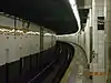 15th Street – Prospect Park Subway Station (IND) |
27 de julio de 2005 | 15th St./Prospect Park W and SW 40°39′37″N 73°58′49″O |
Brooklyn | |
| 2 | Fourth Avenue Station (IND) | 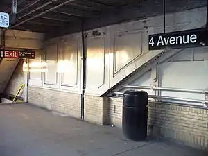 Fourth Avenue Station (IND) |
6 de julio de 2005 | Bet. 3rd and 4th Aves., and 10th and 11th Sts. 40°40′13″N 73°59′24″O |
Brooklyn | |
| 3 | 68th Police Precinct Station House and Stable | 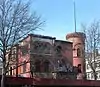 68th Police Precinct Station House and Stable |
3 de junio de 1982 | 4302 4th Ave. 40°39′01″N 74°00′34″O |
Sunset Park | |
| 4 | 75th Police Precinct Station House | 10 de septiembre de 2007 | 484 Liberty Ave. 40°40′29″N 73°53′33″O |
Brooklyn | ||
| 5 | 83rd Precinct Police Station and Stable | 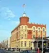 83rd Precinct Police Station and Stable |
14 de abril de 1982 | 179 Wilson Ave. 40°42′06″N 73°55′25″O |
Nueva York | |
| 6 | Ninth Avenue Station (Dual System BRT) | 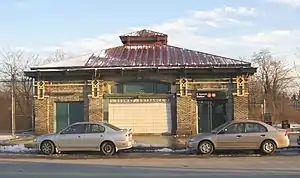 Ninth Avenue Station (Dual System BRT) |
6 de julio de 2005 | 38th St. and 9th Ave. near the junction of New Utrecht Ave. 40°38′47″N 73°59′41″O |
Sunset Park | |
| 7 | Distrito histórico de Albemarle-Kenmore Terraces | 30 de junio de 1983 | Albemarle Terrace, Kenmore Terrace , and E. 21st St. 40°39′03″N 73°57′33″O |
Flatbush | ||
| 8 | Andrews United Methodist Church | 22 de enero de 1992 | 95 Richmond St. 40°41′07″N 73°52′38″O |
East New York | ||
| 9 | Astral Apartments | 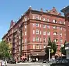 Astral Apartments |
29 de octubre de 1982 | 184 Franklin St. 40°43′54″N 73°57′28″O |
Greenpoint | |
| 10 | Atlantic Avenue Control House | 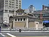 Atlantic Avenue Control House |
6 de mayo de 1980 | Flatbush and Atlantic Aves. 40°41′04″N 73°58′42″O |
Downtown Brooklyn | |
| 11 | Atlantic Avenue Subway Station (IRT and BMT) | Atlantic Avenue Subway Station (IRT and BMT) |
17 de septiembre de 2004 | Junction of Flatbush Ave. at Atlantic and 4th Aves. 40°41′05″N 73°58′42″O |
Downtown Brooklyn | |
| 12 | Atlantic Avenue Tunnel | 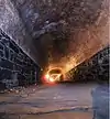 Atlantic Avenue Tunnel |
7 de septiembre de 1989 | Below Atlantic Ave. between Boerum Pl. and Columbia St. 40°41′30″N 74°00′00″O |
Cobble Hill | |
| 13 | Austin, Nichols and Company Warehouse | 28 de junio de 2007 | 184 Kent Ave. 40°43′07″N 73°57′54″O |
Williamsburg | ||
| 14 | Avenue U Station (Dual System BRT) | 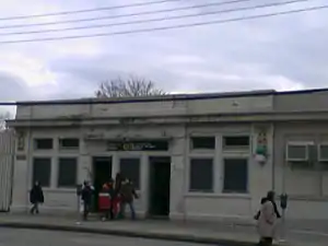 Avenue U Station (Dual System BRT) |
6 de julio de 2005 | Bet. Ave. U and Ave. T and 7th and 8th Sts. 40°35′50″N 73°58′46″O |
Brooklyn | |
| 15 | Baptist Temple (Brooklyn, New York) | 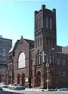 Baptist Temple (Brooklyn, New York) |
20 de noviembre de 1995 | 360 Schermerhorn St. 40°41′11″N 73°58′50″O |
Downtown Brooklyn | |
| 16 | Bay Parkway Station (Dual System BRT) |  Bay Parkway Station (Dual System BRT) |
6 de julio de 2005 | Above Bay Parkway at 86th St. 40°36′06″N 73°59′40″O |
Brooklyn | |
| 17 | Bay Ridge United Methodist Church | 9 de septiembre de 1999 | 7002 Fourth St. 40°38′01″N 74°01′29″O |
Bay Ridge | ||
| 18 | Beth El Jewish Center of Flatbush | 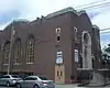 Beth El Jewish Center of Flatbush |
29 de mayo de 2009 | 1981 Homecrest Ave. 40°36′04″N 73°57′35″O |
Flatbush | |
| 19 | Beverley Road Subway Station (BRT pre-Dual System) |  Beverley Road Subway Station (BRT pre-Dual System) |
17 de septiembre de 2004 | Beverley Rd. at Marlborough Rd. 40°38′39″N 73°57′53″O |
Flatbush | |
| 20 | Boathouse on the Lullwater of the Lake in Prospect Park | 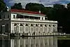 Boathouse on the Lullwater of the Lake in Prospect Park |
7 de enero de 1972 | Prospect Park 40°39′39″N 73°57′55″O |
Prospect Park (Brooklyn) | |
| 21 | Distrito histórico de Boerum Hill | 26 de septiembre de 1983 | Bordeada por Pacific, Wyckoff, Bergen, Nevins, Bond and Hoyt Sts. 40°41′07″N 73°59′13″O |
Boerum Hill | ||
| 22 | Borough Hall Subway Station (IRT) | 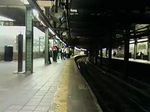 Borough Hall Subway Station (IRT) |
17 de septiembre de 2004 | Junction of Joralemon, Court and Adams Sts. 40°41′32″N 73°59′27″O |
Downtown Brooklyn | |
| 23 | Boy's High School | 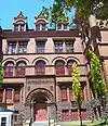 Boy's High School |
25 de febrero de 1982 | 832 Marcy Ave. 40°41′04″N 73°56′54″O |
Bedford-Stuyvesant | |
| 24 | Brooklyn Academy of Music | 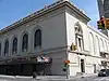 Brooklyn Academy of Music |
2 de mayo de 2006 | 30 Lafayette Ave. 40°41′11″N 73°58′41″O |
Fort Greene | |
| 25 | Brooklyn Borough Hall | 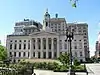 Brooklyn Borough Hall |
10 de enero de 1980 | 209 Joralemon St. 40°41′34″N 73°59′27″O |
Downtown Brooklyn | |
| 26 | Brooklyn Bridge | 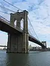 Brooklyn Bridge |
15 de octubre de 1966 | Across the East River from Brooklyn to Manhattan 40°42′23″N 73°59′51″O |
Brooklyn | |
| 27 | Distrito histórico de Brooklyn Heights | 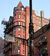 Distrito histórico de Brooklyn Heights |
15 de octubre de 1966 | Borough of Brooklyn, bounded by Atlantic Ave., Court and Fulton Sts. and the East River 40°41′48″N 73°59′48″O |
Brooklyn Heights | |
| 28 | Brooklyn Historical Society |  Brooklyn Historical Society |
17 de julio de 1991 | 128 Pierrepont St. 40°41′41″N 73°59′34″O |
Brooklyn Heights | |
| 29 | Museo de Brooklyn | 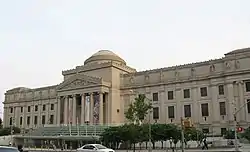 Museo de Brooklyn |
22 de agosto de 1977 | Eastern Parkway and Washington Ave. 40°40′14″N 73°57′51″O |
Prospect Heights | |
| 30 | Edificio de la Biblioteca Pública de Brooklyn-Edificio Central | 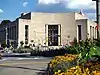 Edificio de la Biblioteca Pública de Brooklyn-Edificio Central |
11 de enero de 2002 | Grand Army Plaza 40°40′20″N 73°58′07″O |
Brooklyn | |
| 31 | Edificio (.+) | 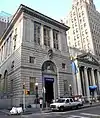 Edificio (.+) |
20 de agosto de 2009 | 177 Montague St. 40°41′39″N 73°59′33″O |
Brooklyn Heights | |
| 32 | Buildings at 375-379 Flatbush Avenue and 185-187 Sterling Place | 7 de septiembre de 1984 | 375-379 Flatbush Ave. and 185-187 Sterling Pl. 40°40′36″N 73°58′19″O |
Brooklyn | ||
| 33 | Distrito histórico de Carroll Gardens | 26 de septiembre de 1983 | Carroll and President Sts. between Smith and Hoyt Sts. 40°40′47″N 73°59′25″O |
Carroll Gardens | ||
| 34 | Casemate Fort, Whiting Quadrangle | 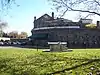 Casemate Fort, Whiting Quadrangle |
7 de agosto de 1974 | Fort Hamilton, off NY 27 40°36′31″N 74°01′58″O |
Brooklyn | |
| 35 | Christ Evangelical English Lutheran Church | 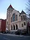 Christ Evangelical English Lutheran Church |
30 de agosto de 2007 | 1084 Lafayette Ave. 40°41′32″N 73°55′45″O |
Brooklyn | |
| 36 | Church of the Holy Innocents |  Church of the Holy Innocents |
16 de junio de 2005 | 279 E. 17th St. 40°38′39″N 73°57′46″O |
Flatbush | |
| 37 | Distrito histórico de Clinton Hill | 19 de junio de 1985 | Bordeada por Willoughby and Grand Aves., Fulton St. and Vanderbilt Ave. 40°41′14″N 73°57′55″O |
Clinton Hill | ||
| 38 | Distrito histórico de Clinton Hill South | 17 de julio de 1986 | Roughly Lefferts and Brevoort Pl. between Washington Ave. and Bedford Pl. 40°40′50″N 73°57′32″O |
Clinton Hill | ||
| 39 | Distrito histórico de Cobble Hill |  Distrito histórico de Cobble Hill |
11 de junio de 1976 | Bordeada por Atlantic Ave., Court, Degraw and Hicks Sts. 40°41′21″N 73°59′47″O |
Cobble Hill | |
| 40 | Coney Island Fire Station Pumping Station |  Coney Island Fire Station Pumping Station |
8 de diciembre de 1981 | 2301 Neptune Ave. 40°34′43″N 73°59′31″O |
Coney Island | |
| 41 | Coney Island Yard Electric Motor Repair Shop | 9 de febrero de 2006 | SW corner of Avenue X and Shell Rd. 40°35′23″N 73°58′31″O |
Brooklyn | ||
| 42 | Coney Island Yard Gatehouse |  Coney Island Yard Gatehouse |
9 de febrero de 2006 | SW corner of Shell Rd. and Avenue X 40°35′22″N 73°58′30″O |
Brooklyn | |
| 43 | Congregation Beth Israel | 30 de abril de 2009 | 203 E. 37th St. 40°39′08″N 73°56′35″O |
Brooklyn | ||
| 44 | Congregational Church of the Evangel | 11 de diciembre de 2009 | 1950 Bedford Ave. 40°39′27″N 73°57′24″O |
Brooklyn | ||
| 45 | Congregation Tifereth Israel | 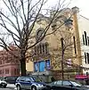 Congregation Tifereth Israel |
11 de enero de 2002 | 1320 Eight Ave. 40°39′47″N 73°58′56″O |
Brooklyn | |
| 46 | Casa William B. Cronyn | 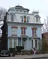 Casa William B. Cronyn |
3 de junio de 1982 | 271 9th St. 40°40′11″N 73°59′16″O |
Nueva York | |
| 47 | Cuyler Presbyterian Church | 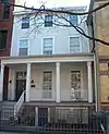 Cuyler Presbyterian Church |
23 de marzo de 2001 | 358-360 Pacific St. 40°41′12″N 73°59′13″O |
Brooklyn | |
| 48 | Cyclone Roller Coaster | 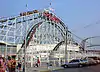 Cyclone Roller Coaster |
25 de junio de 1991 | 834 Surf Ave. at W. 10th St. 40°34′30″N 73°58′44″O |
Coney Island | |
| 49 | Distrito histórico de Cypress Avenue West | 30 de septiembre de 1983 | Bordeada por St. Nicholas and Seneca Aves., Linden and Stockholm Sts. 40°42′15″N 73°54′46″O |
Nueva York | ||
| 50 | Cypress Hills National Cemetery | 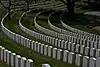 Cypress Hills National Cemetery |
13 de noviembre de 1997 | 625 Jamaica Ave. 40°41′14″N 73°52′55″O |
Brooklyn | |
| 51 | Distrito histórico de Ditmas Park |  Distrito histórico de Ditmas Park |
30 de septiembre de 1983 | Bounded by Marlborough Rd., Dorchester, Ocean, and Newkirk Aves. 40°38′19″N 73°57′40″O |
Ditmas Park | |
| 52 | DUMBO Industrial District | 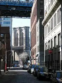 DUMBO Industrial District |
22 de septiembre de 2000 | Bordeada por Main and Washington Sts, East River, John St., Bridge and Jay Sts., and Front and York Sts. 40°42′11″N 73°59′17″O |
DUMBO | |
| 53 | East Midwood Jewish Center | 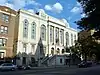 East Midwood Jewish Center |
7 de junio de 2006 | 1625 Ocean Ave. 40°37′20″N 73°57′20″O |
Midwood | |
| 54 | Eastern Parkway |  Eastern Parkway |
26 de septiembre de 1983 | Eastern Pkwy from Grand Army Plaza to Ralph Ave. 40°40′14″N 73°58′08″O |
Brooklyn | |
| 55 | Eighth Avenue (14th Brooklyn Regiment) Armory | 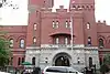 Eighth Avenue (14th Brooklyn Regiment) Armory |
14 de abril de 1994 | 1402 Eighth Ave. 40°39′46″N 73°59′00″O |
Park Slope | |
| 56 | Emmanuel Baptist Church | 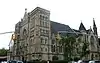 Emmanuel Baptist Church |
16 de diciembre de 1977 | 279 LaFayette Ave. 40°41′17″N 73°58′10″O |
Brooklyn | |
| 57 | Erasmus Hall Academy | 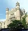 Erasmus Hall Academy |
11 de noviembre de 1975 | Between Flatbush, Bedford, Church, and Snyder Aves. 40°38′58″N 73°57′28″O |
Flatbush | |
| 58 | Evergreens Cemetery | 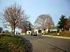 Evergreens Cemetery |
15 de noviembre de 2007 | 1629 Bushwick Ave. 40°41′04″N 73°54′04″O |
Brooklyn | |
| 59 | Edificio Federal y Oficina Postal | 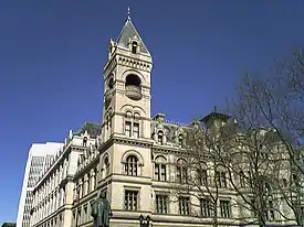 Edificio Federal y Oficina Postal |
9 de octubre de 1974 | 271 Cadman Plaza, E. 40°41′44″N 73°59′24″O |
Downtown Brooklyn | |
| 60 | Feuchtwanger Stable | 20 de marzo de 1986 | 159 Carlton Ave. 40°41′34″N 73°58′22″O |
Brooklyn | ||
| 61 | Flatbush Dutch Reformed Church Complex | 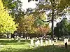 Flatbush Dutch Reformed Church Complex |
8 de septiembre de 1983 | 890 Flatbush Ave. and 2101-2103 Kenmore Terr. 40°39′00″N 73°57′33″O |
Flatbush | |
| 62 | Flatbush Town Hall | 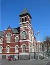 Flatbush Town Hall |
24 de julio de 1972 | 35 Snyder Ave. 40°38′56″N 73°57′26″O |
Flatbush | |
| 63 | Flatlands Dutch Reformed Church |  Flatlands Dutch Reformed Church |
30 de agosto de 1979 | Kings Hwy. and E. 40th St. 40°37′26″N 73°56′13″O |
Flatlands | |
| 64 | Distrito histórico de Floyd Bennett Field |  Distrito histórico de Floyd Bennett Field |
11 de abril de 1980 | Flatbush Ave. 40°35′17″N 73°53′32″O |
Brooklyn | |
| 65 | Distrito histórico de Fort Greene |  Distrito histórico de Fort Greene |
26 de septiembre de 1983 | Bordeada por Ft. Greene Pl., Fulton St., Vanderbilt and Myrtle Aves. • Boundary increase (listed 1984 de septiembre de 7, refnum 84002451): Bordeada por Ashland Pl., DeKalb Ave., Hanson Pl., and Oxford St., Adelphi, Vanderbilt and Myrtle Aves. 40°41′19″N 73°58′19″O |
Fort Greene | |
| 66 | Friends Meetinghouse and School |  Friends Meetinghouse and School |
4 de noviembre de 1982 | 110 Schermerhorn St. 40°41′23″N 73°59′24″O |
Downtown Brooklyn | |
| 67 | Fulton Ferry District | 28 de junio de 1974 | Bordeada por the East River and Washington, Water, Front, and Doughty Sts. 40°42′12″N 73°59′35″O |
Fulton Ferry | ||
| 68 | Gage and Tollner Restaurant | 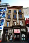 Gage and Tollner Restaurant |
3 de junio de 1982 | 372 Fulton St. 40°41′28″N 73°59′17″O |
Downtown Brooklyn | |
| 69 | Grecian Shelter | 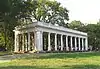 Grecian Shelter |
20 de enero de 1972 | Prospect Park near Parkside Ave. 40°39′13″N 73°58′03″O |
Prospect Park | |
| 70 | Green-Wood Cemetery | 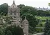 Green-Wood Cemetery |
8 de marzo de 1997 | 500 25th Street 40°39′08″N 73°59′26″O |
Brooklyn | |
| 71 | Distrito histórico de Greenpoint | 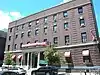 Distrito histórico de Greenpoint |
26 de septiembre de 1983 | Bordeada por Kent, Calyer, Noble, and Franklin Sts., Clifford Pl. and Manhattan Ave. 40°43′43″N 73°57′20″O |
Greenpoint | |
| 72 | Hanson Place Seventh Day Adventist Church | 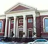 Hanson Place Seventh Day Adventist Church |
23 de abril de 1980 | 88 Hanson Pl. 40°41′07″N 73°58′28″O |
Nueva York | |
| 73 | Holy Trinity Church (Protestant Episcopal) | 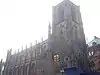 Holy Trinity Church (Protestant Episcopal) |
23 de diciembre de 1987 | 157 Montague St. 40°41′40″N 73°59′35″O |
Brooklyn Heights | |
| 74 | Houses at 216-264 Ovington Ave. | 5 de junio de 2007 | 216-264 Ovington Ave. 40°38′05″N 74°01′42″O |
Brooklyn | ||
| 75 | Casa Hubbard | 2 de junio de 2000 | 2138 McDonald Ave. 40°36′00″N 73°58′25″O |
Brooklyn | ||
| 76 | Distrito histórico de Hunterfly Road | 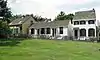 Distrito histórico de Hunterfly Road |
5 de diciembre de 1972 | 1698, 1700, 1702, 1704, 1706, 1708 Bergen St. 40°40′28″N 73°55′35″O |
Weeksville | |
| 77 | Immanuel Congregational Church | 7 de junio de 2006 | 461 Decatur St. 40°40′57″N 73°55′30″O |
Bedford–Stuyvesant | ||
| 78 | Industrial Complex at 221 McKibbin Street | 12 de mayo de 2009 | 221 McKibbin St. 40°42′20″N 73°56′19″O |
Brooklyn | ||
| 79 | Jewish Center of Kings Highway | 12 de febrero de 2010 | 1202-1218 Ave. P 40°36′36″N 73°57′39″O |
Brooklyn | ||
| 80 | Kings County Savings Bank | 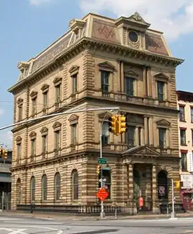 Kings County Savings Bank |
16 de abril de 1980 | 135 Broadway 40°42′37″N 73°57′51″O |
Williamsburg | |
| 81 | Kingsway Jewish Center | 12 de febrero de 2010 | 2810 Nostrand Ave. 40°36′57″N 73°56′41″O |
Brooklyn | ||
| 82 | Knickerbocker Field Club | 29 de octubre de 1982 | 114 E. 18th St. 40°38′52″N 73°57′49″O |
Nueva York | ||
| 83 | Kol Israel Synagogue | 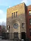 Kol Israel Synagogue |
2 de diciembre de 2009 | 603 St. John's Place 40°40′22″N 73°57′29″O |
Brooklyn | |
| 84 | Distrito histórico de Lefferts Manor |  Distrito histórico de Lefferts Manor |
18 de mayo de 1992 | Bordeada por Lincoln Rd., Fenimore St., Rogers Ave. and Flatbush Ave. 40°39′26″N 73°57′26″O |
Prospect Lefferts Gardens | |
| 85 | Casa Lefferts-Laidlaw | 12 de septiembre de 1985 | 136 Clinton St. 40°41′37″N 73°58′10″O |
Brooklyn Heights | ||
| 86 | Lincoln Club | 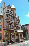 Lincoln Club |
27 de enero de 1983 | 65 Putnam Ave. 40°40′59″N 73°57′35″O |
Brooklyn | |
| 87 | Litchfield Villa | 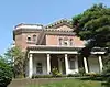 Litchfield Villa |
14 de septiembre de 1977 | Prospect Park W. and 5th St. 40°40′08″N 73°58′26″O |
Prospect Park | |
| 88 | Loew's Kings Theatre | 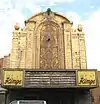 Loew's Kings Theatre |
22 de agosto de 2012 | 1027 Flatbush Ave 40°38′45″N 73°57′27″O |
Flatbush | |
| 89 | Casa Hendrick I. Lott | 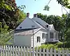 Casa Hendrick I. Lott |
3 de marzo de 1994 | 1940 E. 36th St. 40°36′37″N 73°55′58″O |
Marine Park | |
| 90 | Magen David Synagogue | 15 de abril de 2004 | 2017 67th St. 40°36′54″N 73°59′12″O |
Bensonhurst | ||
| 91 | Manhattan Bridge | 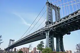 Manhattan Bridge |
30 de agosto de 1983 | Spans East River between Front and Canal St. 40°42′36″N 73°59′18″O |
Downtown Brooklyn | |
| 92 | Monsignor McGolrick Park and Shelter Pavilion | 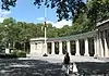 Monsignor McGolrick Park and Shelter Pavilion |
6 de mayo de 1980 | Bounded by Nassau and Driggs Aves., Russell and Monitor Sts. 40°43′28″N 73°56′38″O |
Greenpoint | |
| 93 | New England Congregational Church and Rectory |  New England Congregational Church and Rectory |
15 de septiembre de 1983 | 177-179 S. 9th St. 40°42′31″N 73°57′45″O |
Williamsburg | |
| 94 | New Lots Reformed Church and Cemetery |  New Lots Reformed Church and Cemetery |
19 de mayo de 1983 | 630 New Lots Ave. 40°39′53″N 73°53′08″O |
New Lots | |
| 95 | New Utrecht Avenue Station (Dual System BRT) |  New Utrecht Avenue Station (Dual System BRT) |
6 de julio de 2005 | Beneath the junction of New Utrecht Ave. with 15th Ave. and 62nd St. 40°37′29″N 73°59′48″O |
Brooklyn | |
| 96 | New Utrecht Reformed Church and Buildings |  New Utrecht Reformed Church and Buildings |
9 de abril de 1980 | 18th Ave. and 83rd St. • New Utrecht Reformed Church Complex boundary increase (listed 2001 de marzo de 5, refnum 01000126): 8523 16th Ave. 40°36′30″N 74°00′03″O |
New Utrecht | |
| 97 | New York Congregational Home for the Aged | 5 de noviembre de 2008 | 123 Linden Blvd. 40°39′09″N 73°57′15″O |
Brooklyn | ||
| 98 | Ocean Parkway |  Ocean Parkway |
8 de septiembre de 1983 | From Church Ave. to Seabreeze Ave. 40°36′19″N 73°58′11″O |
Brooklyn | |
| 99 | Ocean Parkway Jewish Center | 11 de diciembre de 2009 | 550 Ocean Pkwy. 40°38′04″N 73°58′23″O |
Brooklyn | ||
| 100 | Ocean Parkway Station (Dual System BRT) |  Ocean Parkway Station (Dual System BRT) |
29 de julio de 2005 | Above the junction of Brighton Beach Ave. and Ocean Pkwy 40°34′35″N 73°58′08″O |
Brighton Beach | |
| 101 | Old Brooklyn Fire Headquarters |  Old Brooklyn Fire Headquarters |
20 de enero de 1972 | 365-367 Jay St. 40°41′34″N 73°59′15″O |
Downtown Brooklyn | |
| 102 | Old First Reformed Church (Brooklyn, New York) |  Old First Reformed Church (Brooklyn, New York) |
1 de abril de 1998 | 729 Carroll St. 40°40′24″N 73°58′37″O |
Park Slope | |
| 103 | Old Gravesend Cemetery |  Old Gravesend Cemetery |
17 de septiembre de 1980 | Gravesend Neck Rd. and MacDonald Ave. 40°35′41″N 73°58′30″O |
Gravesend | |
| 104 | Parachute Jump | 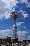 Parachute Jump |
2 de septiembre de 1980 | Coney Island 40°34′21″N 73°59′06″O |
Coney Island | |
| 105 | Distrito histórico de Park Slope |  Distrito histórico de Park Slope |
21 de noviembre de 1980 | Bordeada por Prospect Park West, Berkeley Pl., 15th St., 6th, 7th and Flatbush Aves. 40°40′08″N 73°58′35″O |
Park Slope | |
| 106 | Parkway Theatre | 31 de marzo de 2010 | 1768 St. John's Pl. 40°40′12″N 73°55′08″O |
Brooklyn | ||
| 107 | Plymouth Church of the Pilgrims |  Plymouth Church of the Pilgrims |
15 de octubre de 1966 | 75 Hicks St. 40°41′57″N 73°59′37″O |
Brooklyn Heights | |
| 108 | Distrito histórico de Pratt Institute | 23 de marzo de 2005 | Bordeada por Hall St., Dekalb Ave., Willoughby St. and Emerson Pl. 40°41′28″N 73°57′50″O |
Clinton Hill | ||
| 109 | Prospect Hall |  Prospect Hall |
15 de abril de 1999 | 263 Prospect Ave. 40°39′49″N 73°59′24″O |
Prospect Heights | |
| 110 | Distrito histórico de Prospect Heights |  Distrito histórico de Prospect Heights |
15 de septiembre de 1983 | Bordeada por Pacific and Bergen Sts., Flatbush and Vanderbilt Aves., and Park Pl. 40°40′44″N 73°58′20″O |
Brooklyn | |
| 111 | Prospect Park |  Prospect Park |
17 de septiembre de 1980 | Bounded by Parkside, Ocean and Flatbush Aves., Prospect Park W. and Prospect SW. 40°39′34″N 73°58′14″O |
Brooklyn | |
| 112 | Distrito histórico de Prospect Park South |  Distrito histórico de Prospect Park South |
21 de julio de 1983 | Bordeada por BMT RR Tracks, Beverly Rd., and Coney Island and Church Aves. 40°38′46″N 73°58′01″O |
Flatbush | |
| 113 | Public Bath No. 7 |  Public Bath No. 7 |
12 de septiembre de 1985 | 227-231 Fourth Ave. 40°40′36″N 73°59′00″O |
Park Slope | |
| 114 | Public School 108 | 10 de diciembre de 1982 | 200 Lindwood St. 40°40′52″N 73°53′05″O |
Nueva York | ||
| 115 | Public School 111 and Public School 9 Annex |  Public School 111 and Public School 9 Annex |
14 de diciembre de 1981 | 249 Sterling Place and 251 Sterling Place 40°40′35″N 73°58′11″O |
Fort Greene | |
| 116 | Public School 39 | 17 de abril de 1980 | 417 6th Ave. 40°40′07″N 73°59′02″O |
Park Slope | ||
| 117 | Public School 65K | 10 de diciembre de 1981 | 158 Richmond St. 40°40′59″N 73°52′40″O |
Cypress Hills | ||
| 118 | Public School 7 | 3 de noviembre de 1983 | 131-143 York St. 40°42′06″N 73°59′09″O |
Downtown Brooklyn | ||
| 119 | Public School 71K |  Public School 71K |
4 de noviembre de 1982 | 119 Heyward St. 40°42′06″N 73°57′24″O |
Nueva York | |
| 120 | Quarters A |  Quarters A |
30 de mayo de 1974 | U.S. Naval Facility 40°42′09″N 73°58′49″O |
Brooklyn Navy Yard | |
| 121 | Casa John Rankin | 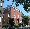 Casa John Rankin |
16 de noviembre de 1978 | 440 Clinton St. 40°40′53″N 73°59′56″O |
Carroll Gardens | |
| 122 | Renaissance Apartments | 22 de agosto de 1995 | 480 Nostrand Ave. 40°40′56″N 73°57′02″O |
Brooklyn | ||
| 123 | Casa John Roosevelt "Jackie" Robinson | 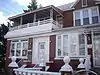 Casa John Roosevelt "Jackie" Robinson |
11 de mayo de 1976 | 5224 Tilden St. 40°38′54″N 73°54′54″O |
East Flatbush | |
| 124 | Distrito histórico de Rockwood Chocolate Factory | 6 de octubre de 1983 | 54-88 Washington, 13-53 Waverly, and 255-275 Park Aves. 40°41′47″N 73°58′06″O |
Fort Greene | ||
| 125 | Russian Orthodox Cathedral of the Transfiguration of Our Lord | 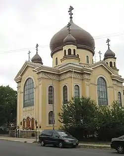 Russian Orthodox Cathedral of the Transfiguration of Our Lord |
16 de abril de 1980 | 228 N. 12th St. 40°43′10″N 73°57′14″O |
Greenpoint | |
| 126 | Casa Saitta | 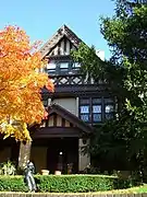 Casa Saitta |
30 de mayo de 2007 | 1135 84th St. 40°37′02″N 74°00′59″O |
Dyker Heights | |
| 127 | Distrito histórico de Senator Street | 10 de octubre de 2002 | 318-370 and 317-347 Senator St. 40°37′50″N 74°01′30″O |
Bay Ridge | ||
| 128 | Shaari Zedek Synagogue | 4 de diciembre de 2009 | 767 Putnam Ave. 40°41′11″N 73°55′51″O |
Bedford-Stuyvesant | ||
| 129 | South Bushwick Reformed Protestant Dutch Church Complex | 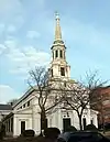 South Bushwick Reformed Protestant Dutch Church Complex |
4 de noviembre de 1982 | 855-857 Bushwick Ave. 40°41′39″N 73°55′34″O |
South Bushwick | |
| 130 | South Congregational Church | 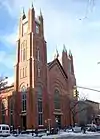 South Congregational Church |
4 de noviembre de 1982 | President and Court Sts. 40°40′55″N 73°59′48″O |
South Brooklyn | |
| 131 | St. Bartholomew's Protestant Episcopal Church and Rectory | 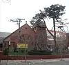 St. Bartholomew's Protestant Episcopal Church and Rectory |
23 de abril de 1980 | 1227 Pacific St. 40°40′41″N 73°57′09″O |
Crown Heights | |
| 132 | St. George's Protestant Episcopal Church | 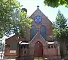 St. George's Protestant Episcopal Church |
8 de septiembre de 1983 | 800 Marcy Ave. 40°41′10″N 73°56′54″O |
Bedford-Stuyvesant | |
| 133 | St. Luke's Protestant Episcopal Church | 16 de septiembre de 1982 | 520 Clinton Ave. 40°40′57″N 73°58′04″O |
Clinton Hill | ||
| 134 | St. Mary's Episcopal Church |  St. Mary's Episcopal Church |
21 de julio de 1983 | 230 Classon Ave. 40°41′34″N 73°57′42″O |
Clinton Hill | |
| 135 | St. Paul's Protestant Episcopal Church |  St. Paul's Protestant Episcopal Church |
21 de diciembre de 1989 | 199 Carroll St. 40°40′55″N 73°58′25″O |
South Brooklyn | |
| 136 | State Street Houses | 17 de enero de 1980 | 291-299, 290-324 State St. 40°41′19″N 73°59′16″O |
Downtown | ||
| 137 | Casa Stoothoff-Baxter-Kouwenhaven |  Casa Stoothoff-Baxter-Kouwenhaven |
14 de noviembre de 1982 | 1640 E. 48th St. 40°37′12″N 73°55′44″O |
Flatlands | |
| 138 | Distrito histórico de Stuyvesant Heights | 4 de diciembre de 1975 | Bordeada por Macon, Tompkins, Decatur, Lewis, Chauncey y Stuyvesant • Boundary increase (listed 1996 de noviembre de 15, refnum 96001355): Roughly, Decatur St. from Tompkins to Lewis Aves. 40°40′52″N 73°56′14″O |
Bedford-Stuyvesant | ||
| 139 | Substation #401 | 6 de julio de 2005 | 3046 Fulton St. bet. Essex St. and Shepherd Ave. 40°40′49″N 73°52′59″O |
East New York | ||
| 140 | Distrito histórico de Sunset Park |  Distrito histórico de Sunset Park |
15 de septiembre de 1988 | Bordeada por Fourth Ave., Thirty-eighth St., Seventh Ave. and Sixty-fourth St. 40°38′38″N 74°00′28″O |
Sunset Park | |
| 141 | Temple Beth El of Borough Park | 27 de abril de 2010 | 4802 15th Ave. 40°37′59″N 73°59′14″O |
Borough Park | ||
| 142 | Twenty third Regiment Armory | 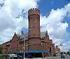 Twenty third Regiment Armory |
6 de mayo de 1980 | 1322 Bedford Ave. 40°40′43″N 73°57′16″O |
Brooklyn | |
| 143 | U.S. Army Military Ocean Terminal | U.S. Army Military Ocean Terminal |
23 de septiembre de 1983 | 58th-65th St. and 2nd Ave. 40°38′41″N 74°01′40″O |
Sunset Park | |
| 144 | US Post Office-Flatbush Station | 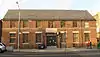 US Post Office-Flatbush Station |
17 de noviembre de 1988 | 2273 Church Ave. 40°39′02″N 73°57′24″O |
Flatbush | |
| 145 | US Post Office-Kensington | 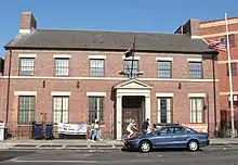 US Post Office-Kensington |
17 de noviembre de 1988 | 421 McDonald Ave. 40°38′37″N 73°58′47″O |
Kensington | |
| 146 | US Post Office-Metropolitan Station | 17 de noviembre de 1988 | 47 Debevoise St. 40°42′06″N 73°56′30″O |
Williamsburg | ||
| 147 | US Post Office-Parkville Station | 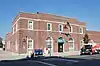 US Post Office-Parkville Station |
17 de noviembre de 1988 | 6618 20th Ave. 40°36′56″N 73°59′15″O |
Bensonhurst | |
| 148 | Casa Joost Van Nuyse | 9 de junio de 2006 | 1128 E. 34th St. 40°37′41″N 73°56′38″O |
Flatlands | ||
| 149 | Distrito histórico de Wallabout | 27 de abril de 2011 | 73-83 & 123-141 Cleremont Ave.; 74-148 & 75-143 Clinton Ave.; 381-387, 403-421 & 455-461 Myrtle Ave.; 74-132 & 69-149 Vanderbilt Ave. 40°41′40″N 73°58′12″O |
Wallabout | ||
| 150 | Distrito histórico de Wallabout Industrial | 7 de agosto de 2012 | Clinton, Flushing, Grand, Park, Washington, & Waverly Aves., Hall, & Ryerson Sts. 40°41′49″N 73°58′01″O |
Wallabout | ||
| 151 | Weir Greenhouse | 10 de mayo de 1984 | 750-751-5th Ave. 40°39′32″N 73°59′47″O |
Sunset Park | ||
| 152 | Williamsburgh Savings Bank | 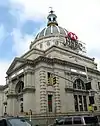 Williamsburgh Savings Bank |
9 de abril de 1980 | 175 Broadway 40°42′36″N 73°57′42″O |
Williamsburg | |
| 153 | Distrito histórico de Willoughby-Suydam | 30 de septiembre de 1983 | Suydam St., Willoughby, St. Nicholas, and Wyckoff Aves. 40°42′21″N 73°55′14″O |
Brooklyn | ||
| 154 | Wilson Avenue Subway Station (Dual System BMT) | 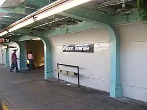 Wilson Avenue Subway Station (Dual System BMT) |
6 de julio de 2005 | Chauncey St. at Wilson Ave. 40°41′19″N 73°54′17″O |
Bushwick | |
| 155 | Casa Pieter Wyckoff | 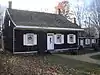 Casa Pieter Wyckoff |
24 de diciembre de 1967 | 5902 Canarsie Lane 40°38′40″N 73°55′16″O |
Flatbush | |
| 156 | Wyckoff-Bennett Homestead | 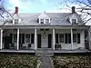 Wyckoff-Bennett Homestead |
24 de diciembre de 1974 | 1669 E. 22nd St. 40°36′39″N 73°57′07″O |
Brooklyn | |
| 157 | Young Israel of Flatbush | 12 de febrero de 2010 | 1012 Avenue I 40°37′37″N 73°57′57″O |
Flatbush |
Véase también
Referencias
- La información de la latitud y longitud proveída en esta tabla fue obtenida originalmente por el Sistema de Información del Registro Nacional de Lugares Históricos, que ha sido verás el 99% de las veces. El 1% de las coordenadas de la NRIS, podrían tener pequeños errores, pero no lejos de su localidad; algunas correcciones se han hecho. Un problema más sutil causa que muchos lugares estén a un máximo de 150 yardas, de su ubicación original, dependiendo de la ubicación en el país: la mayoría de las coordenadas de la NRIS fueron obtenidas de mapas de cuadrantes topográficos de la USGS creados bajo Fecha de utilidad de conversión de América del Norte de 1927, en la cual difiere, de los sistemas actuales GPS usados por Google mapas.
- Numbers represent an ordering by significant words. Various colorings, defined here, differentiate National Historic Landmarks and historic districts from other NRHP buildings, structures, sites or objects.
Enlaces externos
 Wikimedia Commons alberga una categoría multimedia sobre Registro Nacional de Lugares Históricos en Brooklyn.
Este artículo ha sido escrito por Wikipedia. El texto está disponible bajo la licencia Creative Commons - Atribución - CompartirIgual. Pueden aplicarse cláusulas adicionales a los archivos multimedia.