Distrito de Chitrakoot
| Chitrakoot | ||
|---|---|---|
| Distrito | ||
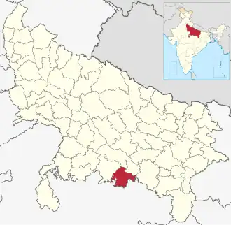 Ubicación del distrito de Chitrakoot en Uttar Pradesh. | ||
| Coordenadas | 25°12′49″N 80°54′55″E / 25.213611111111, 80.915277777778 | |
| Capital | Chitrakoot | |
| Entidad | Distrito | |
| • País |
| |
| • Estado | Uttar Pradesh | |
| Superficie | ||
| • Total | 3164 km² | |
| Población (2011[1]) | ||
| • Total | 990 626 hab. | |
| • Densidad | 309,72 hab./km² | |
| Huso horario | UTC+05:30 | |
| ISO 3166-2 | IN.UP.CT[2] | |
| Sitio web oficial | ||
Chitrakoot (en hindi; चित्रकूट जिला) es un distrito de India en el estado de Uttar Pradesh. Código ISO: IN.UP.CT.[2]
Comprende una superficie de 3 164 km².
El centro administrativo es la ciudad de Chitrakoot.
Demografía
Según censo 2011 contaba con una población total de 990 626 habitantes.[1]
Referencias
Enlaces externos
 Datos: Q2089141