Mons Penck
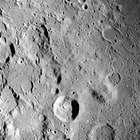
Mons Penck es un promontorio situado en la cara visible de la Luna, justo al nordeste del cráter Kant; y al norte de Ibn-Rushd y del escarpe Rupes Altai. Al sureste de Mons Penck aparecen los prominentes cráteres Theophilus y Cyrillus.
| Mons Penck | ||
|---|---|---|
 | ||
| Coordenadas | 10°00′S 21°44′E | |
| Localización administrativa | ||
| Localización | La Luna | |
| Características generales | ||
| Tipo | Montaña lunar | |
| Altitud | 4 km | |
|
Localización sobre el mapa lunar 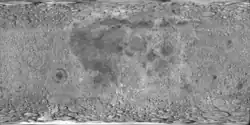 <div style="position: relative; left:Expresión errónea: operador * inesperadopx; top:Expresión errónea: operador * inesperadopx">
 | ||
Las coordenadas selenográficas de esta cumbre son 10,0° de latitud sur y 21,6° de longitud este. Tiene un diámetro de aproximadamente 30 km en la base y se eleva unos 4 km sobre el terreno circundante. Debe su nombre al geógrafo y geólogo alemán Albrecht Penck (1858–1945).[1]
Referencias
- (WGPSN), IAU Working Group for Planetary System Nomenclature (13 de febrero de 2013). «Gazetteer of Planetary Nomenclature. 1:1 Million-Scale Maps of the Moon» (en inglés). UAI / USGS. Consultado el 6 de abril de 2016.
- Andersson, L. E.; Whitaker, E. A., (1982). NASA Catalogue of Lunar Nomenclature (en inglés). NASA RP-1097.
- Blue, Jennifer (25 de julio de 2007). «Gazetteer of Planetary Nomenclature» (en inglés). USGS. Consultado el 2 de enero de 2012.
- Bussey, B.; Spudis, P. (2004). The Clementine Atlas of the Moon (en inglés). Nueva York: Cambridge University Press. ISBN 0-521-81528-2.
- Cocks, Elijah E.; Cocks, Josiah C. (1995). Who's Who on the Moon: A Biographical Dictionary of Lunar Nomenclature (en inglés). Tudor Publishers. ISBN 0-936389-27-3.
- McDowell, Jonathan (15 de julio de 200). «Lunar Nomenclature» (en inglés). Jonathan's Space Report. Consultado el 2 de enero de 2012.
- Menzel, D. H.; Minnaert, M.; Levin, B.; Dollfus, A.; Bell, B. (1971). «Report on Lunar Nomenclature by The Working Group of Commission 17 of the IAU». Space Science Reviews (en inglés) 12: 136.
- Moore, Patrick (2001). On the Moon (en inglés). Sterling Publishing Co. ISBN 0-304-35469-4.
- Price, Fred W. (1988). The Moon Observer's Handbook (en inglés). Cambridge University Press. ISBN 0521335000.
- Rükl, Antonín (1990). Atlas of the Moon (en inglés). Kalmbach Books. ISBN 0-913135-17-8.
- Webb, Rev. T. W. (1962). Celestial Objects for Common Telescopes, 6ª edición revisada (en inglés). Dover. ISBN 0-486-20917-2.
- Whitaker, Ewen A. (2003). Mapping and Naming the Moon (en inglés). Cambridge University Press. 978-0-521-54414-6.
- Wlasuk, Peter T. (2000). Observing the Moon (en inglés). Springer. ISBN 1-85233-193-3.
- «Lunar Impact Crater Database» (en inglés). Lunar and Planetary Institute (USRA). Consultado el 12 de septiembre de 2017.
Véase también
Enlaces externos
 Wikimedia Commons alberga una categoría multimedia sobre Mons Penck.
- LPI. Digital Lunar Orbiter Photographic Atlas of the Moon.
- LTO-78C1 Kant — L&PI topographic orthophotomap mapa.
- Mapa LROC
- Referencia USGS Mons Penck
| Control de autoridades |
|
|---|
 Datos: Q500676
- Multimedia: Mons Penck / Q500676
Este artículo ha sido escrito por Wikipedia. El texto está disponible bajo la licencia Creative Commons - Atribución - CompartirIgual. Pueden aplicarse cláusulas adicionales a los archivos multimedia.